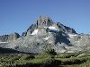
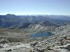
Classic view of Mt. Ritter and Banner Peak.
Thousand Island Lake
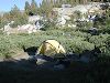
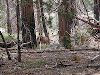
First night's campsite.
Thousand Island Lake.
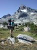
Michelle and her new pack; Ritter and Banner in the background.
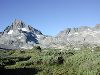
Near Thousand Island Lake
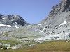
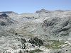
The route for our first off-trail day goes over the pass seen here, between Banner Peak and Mt. Davis.
Thousand Island Lake
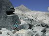
Off trail at last, on the way to North Glacier Pass.
Between Banner Peak and Mt. Davis
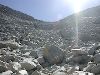
Big blocks on the way to North Glacier Pass.
Banner Peak
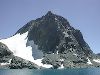
Northwest side of Banner Peak.
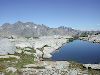
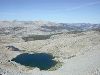
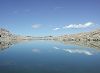
Lake Catherine
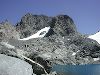
Spur of Mt. Ritter seen from Lake Catherine, just below North Glacier Pass.
Lake Catherine
Looking across the chasm of the North Fork of the San Joaquin river toward one of the Twin Island Lakes (our destination for that night).
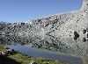
Near the outlet of Lake Catherine
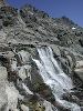
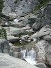
Falls along Lake Catherine's outlet stream.
Near Mt. Ritter
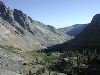
Headwaters of the North Fork San Joaquin river.
North Fork San Joaquin valley
No point in carrying boots across the ford -- toss them across first!
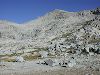
Outlet of North Twin Island Lake
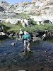
Allen crossing the headwaters of the North Fork San Joaquin.
Outlet of North Twin Island Lake
Looking back on our route down from Lake Catherine.
Near South Twin Island Lake
Looking east to the Ritter Range
West of Twin Island Lakes
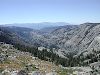
The valley of the North Fork San Joaquin.
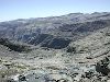
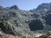
On the slopes above Bench Canyon
Bench Canyon -- beautiful and well off the beaten path.
Above Bench Canyon
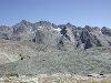
The Ritter Range and Minarets.
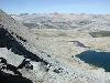
Blue Lake
Blue Lake and environs in the morning.
Blue Lake
Foerster Peak and Blue Lake Pass.
Blue Lake
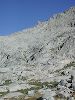
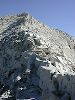
Our route lies up the greenbelt on the right, then across the talus above a cliff to the pass (just visible on the left). Note Allen at lower right.
Blue Lake
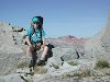
Michelle taking a well-earned rest.
Blue Lake Pass
Michelle with Red Peak (on the other side of the Merced Canyon) in the background.
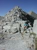
Blue Lake Pass
Where's Allen?
Blue Lake Pass
Blue Lake at the head of Bench Canyon, with the Minarets and the southern Sierra in the distance.
Blue Lake Pass
An unnamed lake and the upper reaches of the Merced Canyon, with the Clark Range at left.
Blue Lake Pass
The talus field below Blue Lake Pass, with the Merced Canyon and the Clark Range in the background.
Just west of Blue Lake Pass
Our next objective: The slopes below Peak 11210. Interesting quartz outcropping between here and there. Mt. Hoffmann in the distance.
Just west of Blue Lake Pass
The talus field west of Blue Lake Pass. We hate this stuff. Boulder in the foreground is about 5 feet in diameter.
Below Blue Lake Pass
The unnamed lake west of Blue Lake Pass. Red Peak in the distance.
Below Blue Lake Pass
Heading down the granite slabs into Merced Canyon, and a very long hike to camp.
Above Merced Canyon
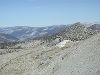
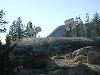
Solar power collectors just outside the Merced Lake High Sierra Camp.
Near Merced Lake
A rainy final day on the trail.
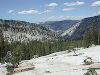
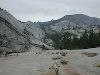
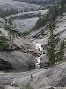
Merced Canyon
Graceful granite along the Merced River. (Credit goes to Michelle for this one.)
Merced Canyon
Pools and falls along the Merced River.
Merced Canyon
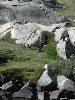
Local residents.
Little Yosemite Valley
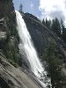
Nevada Fall
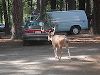
Searching for apples (or handouts) in the old Curry orchard parking lot.
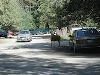
Yosemite Valley
Avoiding the paparazzi.
Yosemite Valley